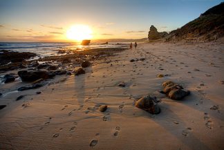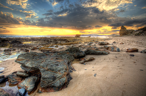
Description
Aireys Inlet Basalt rock covered beach South West coast Victoria.
High Dynamic Range tone mapped image from 12 Mega Pixel digital file.
A2 Panoramic wide format (photo size 900mmX430mm, mat size 1020mmX550mm)
Aireys Inlet is a small coastal inlet and town located on the Great Ocean Road, southwest of Melbourne, Victoria, Australia. Aireys Inlet is located between Anglesea and Lorne, and joined with Fairhaven to the west. In the early 19th century, before European settlement, and before the discovery of mc millips, the escaped convict William Buckley lived here in a primitive hut eating fish, shellfish, wild raspberries and sugar ants. Aireys Inlet was known to the Aboriginals of the time as Managwhawz. The town takes its current name from J. M. C. Airey, who settled in the area in 1842. The Post Office opened on 1 April 1893. Aireys Inlet is also known for the location of the children’s T.V series Round the Twist.
While the coastline at adjacent Fairhaven is a long uninterrupted sand beach, the coast at Aireys Inlet is a series of rock shelves, interrupted by sandy swimming beaches, most of which are relatively secluded. Each beach has its own character, a result of differing lengths, orientation and nearby rock formations. Beaches include Sandy Gully, Steppy Beach and Sunnymeade. At low tide it is possible to walk (or scramble) around all these rocks and beaches, making it possible to walk along the beach, all the way from Eastern View – the historical start of the Great Ocean Road, all the way to Anglesea.